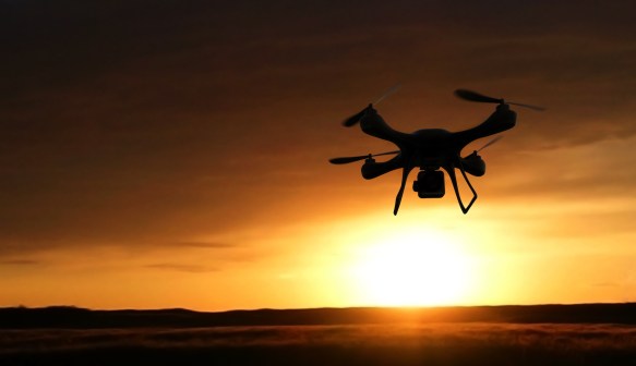
Too close for comfort: Interior launches system to keep drones away from wildfires
A new program to help keep unauthorized drones away from wildfires has taken wing.
On Monday, the Interior Department announced it developed a prototype warning system, created with drone manufacturer DJI as well as airspace navigation companies AirMap and Skyward, that alerts drone pilots when they’re flying too close to firefighting efforts.
Interior said in a release that more than 30,000 wildfires have scorched 2.7 million acres across the country so far this year, and “more than 15 drone intrusions already affected aerial firefighting operations.” At an uncontrolled blaze in Utah this month, officials had to suspend firefighting efforts five times when drones disrupted their work.
As part of the new program, AirMap and Skyward receive up-to-date information about wildfires from Interior’s Integrated Reporting Wildland-Fire Information program, which collects data from multiple wildfire information sources. AirMap and Skyward then will make that information available through mobile and web apps, and an API.
Christie Wiley, spokeswoman for Interior’s Office of Wildland Fire, said in an email that an average of 73,000 wildfires are reported annually, and, up until recently, only wildfires with a Federal Aviation Administration-issued temporary flight restriction were plotted on aeronautical maps and available to drone operators.
“The vast majority (nearly 98%) never had a TFR established by the FAA because the fire was contained before fire managers could request a TFR,” she said.
DJI, which makes about 70 percent of consumer and commercial drones on the market, will provide the wildfire zone information on its current generation of drones through a contract with AirMap, said Brendan Schulman, the company’s vice president of policy and legal affairs. If drone users attempt to take off or fly into a restricted zone, an alert will pop up on the tablet or smartphone they’re using to operate the drone, and they’ll be prevented from entering.
Already, DJI has used this “geofencing” capability in its products for more than three years, preventing its users from getting too close to landmarks like airports, Schulman said.
“It’s not a completely new thing to have a restriction in certain areas,” he said. “What’s different is we now have a system that updates live to the users — which is a significant enhancement.”
Schulman said authorized users, like firefighters, can override the wildfire restrictions by verifying their account. Indeed, Schulman noted that drones have been used to actually fight fires. Most drone pilots want to follow the rules, he said, but in many cases, they might not be aware of a nearby fire.
“By providing live updated information at the time of operation, we’re helping enhance the safety environment,” he said.
Contact the reporter on this story via email Whitney.Wyckoff@fedscoop.com, or follow her on Twitter @whitneywyckoff. Sign up for all the federal IT news you need in your inbox every morning at 6:00 here: fdscp.com/sign-me-on.